|
|
 |
|
|
 |
 |
| Cities' maps |
 |
| |
 |
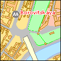
The cities' maps are building detailed. On the cities' maps you can see the city's financial, cultural-entertainment, medicine and other institutions. You can find a street and other objects on the map by their names, numbers of buildings and constructions, their addresses. Search of objects of maps in the name.
|
|
|
 |
 |
 |
| Countries' maps |
 |
|
 |
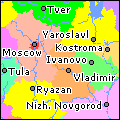
The maps include information on cities, rivers and lakes, arterial highways and railways, airports and seaports. Search of objects of maps in the name.
|
|
|
 |
 |
 |
| MapInfoDATA© Cartique™. Sample maps |
 |
|
 |
A comprehensive and detailed vector data set for the whole of Europe, beautiful, clear cartographic output. Contains five classes of roads including motorways, single and dual carriageways; principal roads; regional roads; local roads and other roads; motorway exits and junctions; rest areas and toll booths; airports and ferries; urban areas; international and selected administrative boundaries; open water and coastline. Structured into 28 layers for flexible display. An extensive gazetteer is also supplied, giving the locations of more than 320000 cities, towns, villages and selected suburbs across Europe. Geographic Coverage : Europe. Scale : 1:300000. Vintage Date: 2002.
Cartique™ Mapping
|
|
|
 |
 |
 |
| ADC WorldMap Digital Atlas 4.0. Sample maps. |
 |
|
 |
The most detailed digital atlas offering seamless geographic data for the entire world. Endless scores of up-to-date information and detail-rich layers enhance your desktop mapping capabilities and make ADC WorldMap Digital Atlas 4.0 an ideal product for a multitude of applications.
©2002 American Digital Cartography, Inc. All Rights Reserved
|
|
|
 |
|
|
|